- หน้าแรก /
- หนังสือ /
- Engineering & Transportation /
- Engineering /
- Computer Modelling /
- Remote Sensing & GIS /
- Introduction to Spatial Data Analysis
0 ratings





รายการ #:
145383070
Introduction to Spatial Data Analysis
ผู้ซื้อ 90% แนะนำสินค้านี้ให้เพื่อน
รายการ #:
145383070
THB 2307
รายละเอียดราคา
ไม่รวมค่าจัดส่งและค่าธรรมเนียมศุลกากร ( ค่าจัดส่งและค่าธรรมเนียมศุลกากรจะคำนวณตอนชำระเงิน )
*สินค้าทั้งหมดจะนำเข้าจาก สหรัฐอเมริกา
0 ratings
เขียนรีวิว
มีสินค้า
 นำเข้าจาก USA ร้านค้า
จำนวน:
เหลือเพียง 2 รายการในสต็อก
สั่งซื้อตอนนี้และรับสินค้าประมาณ Sunday, ตุลาคม 18
การทำธุรกรรมที่ปลอดภัย
Ubuy ทำงานอย่างหนักเพื่อปกป้องความปลอดภัยและความเป็นส่วนตัวของคุณ ระบบรักษาความปลอดภัยการชำระเงินขั้นสูงของเราช่วยให้ข้อมูลของคุณเป็นความลับ โดยการเข้ารหัสข้อมูลระหว่างการส่งโดยใช้โปรโตคอล AES (Advanced Encryption Standards) และ SSL (Secure Socket Layer) รายละเอียดการชำระเงินของคุณปลอดภัย 100% เนื่องจากเราไม่แบ่งปันข้อมูลการชำระเงินของคุณกับผู้ขายบุคคลที่สาม
พันธมิตรด้านโลจิสติกส์ชั้นนำของเรา


This book empowers readers to turn field data into actionable spatial insights using QGIS and R.

Fast
Shipping

คืนสินค้าฟรี*

แพ็คสินค้าอย่างปลอดภัย

สินค้าแท้ 100%

ผ่านมาตรฐาน PCI DSS

ได้รับการรับรอง ISO 27001












Note: Step Down Voltage Transformer required for using electronics products of สหรัฐอเมริกา store (110-120). Recommended power converters ซื้อเลย.


จุดเด่น
Comprehensive Overview
Covers foundational concepts and advanced techniques in spatial data analysis, making it suitable for beginners and seasoned analysts alike.
Hands-On Learning
Includes practical exercises and real-world case studies, allowing users to apply concepts and solidify their understanding effectively.
Interdisciplinary Approach
Integrates knowledge from geography, statistics, and computer science, ensuring a well-rounded perspective on spatial issues and their solutions.
รายละเอียดสินค้า
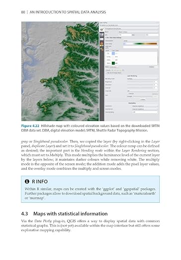
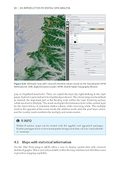
- This is a book about how environmental scientist can integrate remote sensing and GIS in their research. It will allow readers to get started with the application of remote sensing as well as GIS and to understand its potential and limitations. Using practical examples, the book covers all necessary steps from planning field campaigns to deriving relevant environmental information through remote sensing and modelling of species distributions.This book introduces spatial data handling using the open source software Quantum GIS (QGIS). In addition, readers will be guided through their first steps in the R programming language. The authors explain the fundamentals of spatial data handling and analysis, empowering the reader to turn data acquired in the field into actual spatial data. Readers will learn to process and analyse spatial data of different types and interpret the data and results. After finishing this book, readers will be able to address questions such as What is the distance to the border of the protected area?, Which points are located close to a road?, Which fraction of land cover types exist in my study area? using different software and techniques. This book is for novice spatial data users and does not assume any prior knowledge of spatial data itself or practical experience working with such data sets. Readers will likely include student and professional ecologists, geographers and any environmental scientists or practitioners who need to collect, visualize and analyse spatial data. The software used will be the widely applied open source scientific programs QGIS and R. All scripts and data sets used in the book will be provided online at book.ecosens.org. This book covers specific methods including:* what to consider before collecting in situ data* how to work with spatial data collected in situ* the difference between raster and vector data* how to acquire further vector and raster data* how to create relevant environmental information* how to combine and analyse in situ and remote sensing data* how to create useful maps for field work and presentations* how to use QGIS and R for spatial analysis* how to develop analysis scripts
| Publisher | Pelagic |
| Publication date | November 7, 2020 |
| Language | English |
| Print length | 300 pages |
| ISBN-10 | 1784272132 |
| ISBN-13 | 978-1784272135 |
| Item Weight | 1.1 pounds (500 grams) |
| Dimensions | 6.76 x 0.43 x 9.68 inches (17.2 x 1.1 x 24.6 cm) |
| Part of series | Data in the Wild |
เหมาะสำหรับใคร?

-
Students in Geography
Ideal for geography students seeking foundational knowledge in spatial data methods and analysis techniques.
-
Urban Planners
Urban planners can enhance their skills in analyzing spatial data to inform their city planning and zoning decisions.
-
Environmental Researchers
Environmental researchers benefit by learning spatial analysis for better understanding of ecological patterns and resource management.

-
Casual Hobbyists
Not suitable for casual hobbyists who prefer simple geographic tools without in-depth analytical techniques.
ข้อมูลผลิตภัณฑ์
มีข้อสงสัย? คุยกับเรา
คำถามและคำตอบของลูกค้า
-
คำถาม:
จะซื้อ Introduction to Spatial Data Analysis ทางออนไลน์จาก Ubuy ได้อย่างไร
คำตอบ: ซื้อสินค้า Introduction to Spatial Data Analysis ทางออนไลน์จาก Ubuy ได้ง่ายๆ. คุณเพียงแค่ต้องค้นหาสินค้า เลือกวิธีการจัดส่งของคุณในขณะที่ทำการชำระเงิน และส่งไปยังสถานที่ของคุณ -
คำถาม:
Introduction to Spatial Data Analysis มีให้ช็อปออนไลน์ใน Thailand หรือไม่
คำตอบ: ใช่ ที่ Ubuy Thailand ผลิตภัณฑ์นี้มีให้คุณเลือกซื้อในราคาที่เหมาะสม. Introduction to Spatial Data Analysis ไม่มีให้บริการในพื้นที่ แต่คุณสามารถไว้วางใจเราด้วยบริการจัดส่งด่วนของเรา -
คำถาม:
ใช้เวลานานแค่ไหนในการรับสินค้าหลังจากทำการสั่งซื้อ?
คำตอบ: เวลาจัดส่งของผลิตภัณฑ์ที่คุณสั่งซื้อจะแตกต่างกันไปตามสิ่งที่คุณสั่งซื้อและวิธีการจัดส่งที่คุณเลือก. เวลาจัดส่งโดยประมาณจะระบุไว้ในขั้นตอนการชำระเงิน ดังนั้นโปรดอย่ากังวลขณะช้อปปิ้ง
Remote Sensing & GIS Editorial Review
Introduction to Spatial Data Analysis is a comprehensive guide published by Pelagic on November 7, 2020, that spans 300 pages and delves deep into the intricacies of spatial data. This resourceful book is written in English and is ideal for both newcomers and seasoned professionals in the field. It covers various analytical methods and their applications, providing readers with a robust understanding of spatial data's role in research and decision-making. The book's dimensions make it manageable for fieldwork while still offering extensive content to enhance knowledge in spatial analysis.
ความคิดเห็นและคะแนนจากลูกค้า
11 การให้คะแนนของลูกค้า
-
5 ดาว
76%
-
4 ดาว
0%
-
3 ดาว
12%
-
2 ดาว
12%
-
1 ดาว
0%
แบ่งปันความคิดของคุณกับลูกค้าท่านอื่น
แชร์ความคิดของคุณกับลูกค้ารายอื่น
ข้อดี
- Engaging content covering analytical methods
- Ideal for both beginners and professionals
- Thorough exploration of spatial data applications
- Well-organized with clear explanations
- Portable size for fieldwork
ข้อเสีย
- Some concepts may require additional background knowledge
Customers also viewed these products
ประวัติราคาสินค้า
ข้อมูลสำคัญ
- ข้อจำกัด: สำหรับสินค้าที่จัดส่งระหว่างประเทศ โปรดทราบว่าการรับประกันจากผู้ผลิตอาจไม่มีผลบังคับใช้ บริการหลังการขายจากผู้ผลิตอาจไม่สามารถใช้งานได้ คู่มือผลิตภัณฑ์ คำแนะนำการใช้งาน และคำเตือนด้านความปลอดภัยอาจไม่ได้จัดทำเป็นภาษาของประเทศปลายทาง สินค้า (รวมถึงเอกสารประกอบ) อาจไม่ได้ออกแบบให้สอดคล้องกับมาตรฐาน ข้อกำหนด และข้อบังคับด้านฉลากของประเทศปลายทาง และสินค้าอาจไม่สอดคล้องกับแรงดันไฟฟ้าและมาตรฐานทางไฟฟ้าอื่น ๆ ของประเทศปลายทาง (ซึ่งอาจต้องใช้ปลั๊กแปลงไฟหรือเครื่องแปลงแรงดันไฟฟ้าตามความเหมาะสม) ผู้รับสินค้ามีหน้าที่รับผิดชอบในการตรวจสอบว่าสินค้าดังกล่าวสามารถนำเข้าประเทศปลายทางได้อย่างถูกต้องตามกฎหมาย เมื่อสั่งซื้อสินค้าจาก Ubuy หรือบริษัทในเครือ ผู้รับสินค้าจะถือเป็นผู้นำเข้าตามกฎหมาย (Importer of Record) และต้องปฏิบัติตามกฎหมายและข้อบังคับทั้งหมดของประเทศปลายทาง
- ผลิตภัณฑ์บางรายการใน Ubuy ไม่ได้มีไว้เพื่อขาย เนื่องจาก Ubuy เป็นเครื่องมือค้นหาระดับโลก ผลิตภัณฑ์อยู่ภายใต้กฎระเบียบด้าน การส่งออก/การค้า
THB 2307
สั่งซื้อตอนนี้และรับสินค้าประมาณ Sunday, ตุลาคม 18
สินค้านี้ไม่ถูกจำกัดในประเทศของฉัน (หากสินค้านี้ไม่ถูกจำกัดในประเทศของคุณ กรุณาคลิกลิงก์ด้านบน ทีมงานของเราจะตรวจสอบและเปิดให้สั่งซื้อ)
จำนวน:
เหลือเพียง 2 รายการในสต็อก
การทำธุรกรรมที่ปลอดภัย
ได้รับการรับรอง PCI DSS และ ISO 27001:2022 พร้อมการชำระเงินแบบเข้ารหัสและการคุ้มครองผู้ซื้อเต็มรูปแบบทุกคำสั่งซื้อ
พันธมิตรด้านโลจิสติกส์ชั้นนำของเรา
การจัดส่งข้ามพรมแดนที่เร็วที่สุด
คุณสมบัติและประโยชน์
- Integrates remote sensing and GIS for environmental research.
- Practical examples guide the application of spatial data analysis.
- Includes foundational training in QGIS and R programming.
- Covers methods for dealing with in situ data and its analysis.
- Equips readers to answer critical environmental questions.
- Designed for novices without prior spatial data experience.
การรับประกันจาก Ubuy
ช้อปสบายใจไร้กังวล ด้วยสินค้าของแท้ 100% ระบบชำระเงินปลอดภัยได้มาตรฐาน PCI DSS การปกป้องข้อมูลด้วยมาตรฐาน ISO 27001 การจัดส่งข้ามพรมแดนที่รวดเร็วที่สุด คืนสินค้าฟรี และบรรจุภัณฑ์ที่ปลอดภัยในทุกคำสั่งซื้อ*